Book your pitch and pay for it the day before your departure, the newfound freedom of the real camper !
Tourism in Corrèze | Holidays, weekends and activites
Camping les sapins de corrèze
Offers and Promotions visible in "Book" - Meetch, our complete cancellation insurance!
La vallée en Corrèze

Discover
the tourism in Corrèze

Notre camping est idéalement situé pour découvrir le tourisme en Corrèze, se promener et randonner. Corrèze has the largest number of mountain biking tracks of France with all levels of difficulties from family path to expert tracks.

The camping is located at the heart of the Haute Corrèze between the plateau de Millevaches and the Gorge de la Haute Dordogne, at Palisse, where the Vianon stream flows. A perfect place to explore the natural and cultural treasures of the beautiful region, with numerous lakes, waterfalls, free swimming spots and aquatic bases.

In Corrèze, holidays could be relaxing or sporty, on land or marine or even in the air, you have the choice! With kids, friends, family, solo or in couple you will find happiness.

You will have something for everyone. An interactive map is available helps you to find what you fancy around the camping!

Hiking Trails and Trekking

In Corrèze, the possibilities for walks are endless, from the Plateau de Millevaches to the Dordogne Valley, on horseback, by mountain bike, or on foot —beautiful getaways await you.

From the campsite, you can directly start the hike “Au Coeur de la Forêt Corrézienne“ (12 km – yellow markings – easy)

You will discover the village of Palisse where the campsite is located, with its unique bell tower in France, the Corrèze forest with its mix of deciduous and coniferous woods.

Another departure from the campsite 18km “Les Sapins de Corrèze“, set off to discover the foresters’ trails, follow the border of the Plateau de Millevaches to land on the banks of the Triouzoune where an improvised picnic can then go up towards the hamlets of Palisse and its gray stone houses and its roofs. slates along the Vianon.

The campsite is located near the Le Vianon River, which merges with the Luzège a little further down the course. For a more adventurous expedition, take the trail “Sentier des Charbonniers” (9.4 km – yellow markings – medium), from the Plateau aux Gorges du Vianon and La Luzège. After a refreshing descent to the rocky chaos on the Vianon, come and immerse yourself in the iconic site of the Vieille Église. A recently restored historical monument, in the heart of the Luzège Valley on the site of Gour Noir (Belvedere).

Between the campsite and Lac de la Triouzoune, 9.4 km hike “A la Découverte de la Forêt” overlooking Neuvic, explore the Puy Chaffaud arboretum for the pleasure of learning, as a family or alone, to differentiate between them. the species. Then explore the forests whose management has been entrusted to the ONF (National Forestry Office) and take a break at the edge of the Vergne pond.

Les randonnées en Corrèze

Last hiking recommendation (8 km – red markings – easy) near the campsite: « Ventadour discovery ». .” It is between the slope of the streams Vigne and Soudeillette, on a rocky escarpment, that one of the most important and impregnable castles was built: that one of the most important and impregnable castles was built: le fief des Ventadour. (Visit to the ruins for a fee).

To discover all the walks and hikes in the region, please visit the Corrèze Rando website: Corrèze Rando, which lists all the routes through an interactive map !

Corrèze offers numerous flagship multi-day
hiking itineraries.

Circuits VTT en Corrèze

Mountain Bike Trails

With a rich offering of mountain biking circuits and itineraries, get ready for an adrenaline rush! Venture into the Haute-Corrèze mountain biking area, the largest FFVélo (French Cycling Federation) certified network in France, boasting over 1,000 km of marked trails.

Let your desire for exploration guide you through a wide range of cycling routes inviting you to discover the Millevaches Natural Park, give up yourself within the beautiful colours of the landscapes that line the Gorges and Vallée de la Dordogne, or challenge yourself by reaching new heights at Mont Bessou. To ease your exploration and enhance your experience, each circuit comes with a technical presentation and points of interest along the way.

You can start directly from our campsite to follow the 12km “In the heart of the Corrézienne Forest” and 18km “Les Sapins de Corrèze” family circuits.

For the most sporty, Trail #5 ‘’ Sur les Terres de Ventadour ‘’ a 52 km route, and two FFC-circuits “Zig Zag en Haute-Corrèze“: Trail #9 “Les Ruisseaux” a 40 km route and #10 “Les Etangs” a 58 km route.

A short wort about ‘LA CORRÉZIENNE VTT’:
With La Corrézienne VTT, tour Corrèze to visit the local heritage, both natural and cultural.

The campsite is present as a stopover in sectors 21 and 22.

Lakes and Water Bodies

Along the shores of lakes, swim in our Blue Flag (Pavillon Bleu) certified waters. The campsite is situated at the crossroads of several lakes:

LAKE DE LA TRIOUZOUNE, 10MIN AWAY :

Supervised swimming from July 1st to August 31st, from 12 pm to 7 pm every day.

The lake offers a large range of activities through its nautical base: sailing, windsurfing, water skiing, jet skiing, pedal boats, stand-up paddleboarding, canoeing, motor boating, fishing, volleyball courts, and more.

Adapted for people with reduced mobility and certified “handiplage,” the beach also features a water-accessible floating wheelchair.

LAKE D'EGLETONS, ALSO KNOWN AS LAKE DU DEIRO, 15MIN AWAY :

Supervised swimming in July and August, open all year round.

LAMAZIERES-BASSE FISHING PONDS, 5 minutes away:

Fishing is open on the ponds from May 1st to the first Sunday in November.
Card €35 (for fishing on the Viers and Montsour ponds), €15 for young people aged 12 to 18, free for children under 12.
Day fishing at the Ganes pond, weekends and public holidays (maximum 6 catches allowed): 10 Euros per day.

Découvrez les Lacs et plans d’eau de Corrèze

Lake Séchemailles in Meymac, 20 minutes away:

Supervised swimming from July 1st to August 31st, from 2 pm to 7 pm every day.

On the Meymac beach, you will find a leisure base in July and August offering canoe-kayak rentals, pedal boats with slides, and stand-up paddleboarding. Picnic areas and children’s play areas are available. Orienteering courses and hiking trails are also among the activities at this lake.

The Cascades du Deiro above Egletons (20 minutes away):

a perfect spot for a family stroll and a picnic in the shade by the Le Deiro stream, a space that we personally love with our dogs.

Cultural Heritage

Corrèze boasts a remarkable cultural heritage, including numerous medieval towns, Gallo-Roman sites, museums, and educational farms.

Among the towns and villages of character, you’ll find Palisse, where the campsite and its characteristic church are located in the center (10 minutes by walk). The town of Meymac (20 minutes by car) stands out especially for its religious architecture (Eglise de Saint-Léger). The village of Saint Angel (15 minutes away) is also noteworthy, with its splendid church called Prieuré Saint-Michel des Anges. Lastly, Bort les Orgues, classified among astonishing sites, is where you’ll find the Château de Val (40 minutes away).

Corrèze has been historically forged by numerous medieval wars, and you can admire the remains of Ventadour Castle (20 minutes away), overlooking the entire Corrèze.

Special for children:

Educational Farms (Fermes Pédagogiques) offer various fun activities. Just 10 away minutes from the campsite (30 minutes by bike), you’ll find Ferme Lama’ziere in Lamaziere-Basse.

Nearby Museums:

  • Departmental Museum of Resistance “Henri Queuille” in Neuvic (15 minutes)
  • Medieval Discovery Center in Egletons (20 minutes)
  • Museum of the Ussel region (15 minutes)
  • Museum of Archaeology & Heritage Marius Vazeilles (20 minutes).

Not to be missed for our road trippers.

Among the most beautiful villages in France, Corrèze has 6 on its territory: Beaulieu-sur-Dordogne (1 hour and 20 minutes), Collonges-la-Rouge (1 hour and 30 minutes), Curemonte (1 hour and 20 minutes), Saint-Robert (1 hour and 30 minutes), Ségur-le-Chateau (1 hour and 30 minutes), and Turenne (1 hour and 25 minutes).

Vallée et Gorges de la Dordogne

La Vallée en Corrèze - Haute Dordogne

In Corrèze, we are fortunate to have a wide variety of canoeing and kayaking routes, especially near the campsite. Just 30 minutes away, you’ll find the Dordogne in the village of ROCHE-LE-PEYROUX.

Canoeing, kayaking, rafting, and aquatic hiking providers and departure points await you! Two rowing centre are also set up on Lake Sèchemailles in Meymac (20 minutes).

For the fan of of waterway strolls in Corrèze, boat trips on a Gabare (flat-bottomed boat) invite you to explore the Gorges and the Dordogne Valley, following in the footsteps of the intrepid navigators known as gabariers. They used to transport loads of wood for the vineyards and cooperages of Bordeaux. The nearest one to the campsite is in Soursac (25 minutes).

Boat trips are also offered on the Val Lake in Bort-les-Orgues (40 minutes).

Plateau de Millevaches

Millevaches or a thousand sources… it is here, amidst bogs and streams, deciduous forests and heather carpets, that you will encounter remarkable fauna and flora.

A land of legends, but also a land of hikes where Gallo-Roman remains and monumental crosses serve as landmarks in immensely magical landscapes.

From the campsite, the Gates of the Plateau begin from Meymac (20 minutes), where you can admire or explore Mont Bessou and its panoramic tower at 1000 meters high, offering breathtaking views of the Monts du Cantal and Auvergne.

Our favourite:

The Gaulish village of Variéras:

we also recommend the Gaulish village of Variéras (40 minutes) in the village of Pérols-sur-Vézère.

Interactive map

928 résultats
Types de pratiques
Difficulté
Distance
Durée
Catégories
Auteurs
Date
Réinitialiser les filtres
Sélectionner le fond de carte

PLAN IGN

PLAN IGN

PHOTOS AERIENNES / IGN

PHOTOS AERIENNES / IGN

CARTES MULTI-ECHELLES / IGN

CARTES MULTI-ECHELLES / IGN

TOP 25 IGN

TOP 25 IGN

CARTE DES PENTES (PLAN IGN)

CARTE DES PENTES (PLAN IGN)

PARCELLES CADASTRALES

PARCELLES CADASTRALES

CARTES AÉRONAUTIQUES OACI

CARTES AÉRONAUTIQUES OACI

CARTE 1950 / IGN

CARTE 1950 / IGN

CARTE DE L'ETAT-MAJOR (1820-1866)

CARTE DE L'ETAT-MAJOR (1820-1866)

CARTES LITTORALES / SHOM/IGN

CARTES LITTORALES / SHOM/IGN

SCAN EXPRESS STANDARD / IGN

SCAN EXPRESS STANDARD / IGN

SCAN EXPRESS CLASSIQUE / IGN

SCAN EXPRESS CLASSIQUE / IGN

OPEN STREET MAP

OPEN STREET MAP

GOOGLE MAP - SATELLITE

GOOGLE MAP - SATELLITE

GOOGLE MAP - PLAN

GOOGLE MAP - PLAN

GOOGLE MAP - HYBRIDE

GOOGLE MAP - HYBRIDE

IGN BELGIQUE

IGN BELGIQUE

Image du poi

Sacrés monuments Palisse

Une invitation e (re)visiter nos églises à travers un moment dansé, poésie de l'instant dans un édifice culturel. Restitution du projet Education Artistique et Culturelle lumière, transparence, couleur, des élèves de Palisse, Lamazière-Basse, Soursac et Neuvic.

Place de l'église 19160 PALISSE
Le 03/06/2024
- Office de Tourisme de Haute-Corrèze -
Image du poi

Eglise de Palisse

L'église romane du XIIème siècle présente une particularité assez rare en France, son clocher est en effet séparé du reste de l'église et placé perpendiculairement à l'entrée.

19160 PALISSE
- Office de Tourisme de Haute-Corrèze -
Image du circuit

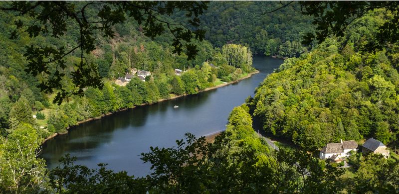
Au coeur de la forêt corrézienne

Après avoir admiré le clocher campanile unique en France, partez à la découverte de la forêt corrézienne avec ses boisements de feuillus et résineux. Puis empruntez les traces des villageois qui rejoignaient le bourg par une magnifique ligne de crête boisée de chênes et de hêtres où le houx tient une place importante, forêt qui abrite de nombreux oiseaux et animaux sauvages à observer. Balisage jaune.

12 km
3h
Modéré
Eglise 19160 PALISSE
- Corrèze Tourisme -
Image du poi

Monument funéraire

Au sommet d’une butte, vous remarquerez une boite aux lettres et un peu au-dessus un monument funéraire à la mémoire du capitaine Emmanuel Moriuser. Ce dernier s’est tué lors du crash de son rafale en 2007 au cours d’un exercice de combat aérien.

- Syndicat mixte d'aménagement et de gestion du Parc naturel Régional de Mlillevaches en Limousin -
Image du poi

Panorama de Pellassiauve

Peu après le village de Pellassiauve, à la faveur d’une récente coupe de bois, se découvre sur la gauche le massif des Monédières, un ensemble d’une trentaine de puys aux formes arrondies qui ne dépassent pas 920 m. Au nord de ce massif, reconnaissable à ses antennes, le Mont Bessou (977 m), point culminant du Limousin. En s’avançant d’une cinquantaine de mètres, sur la droite, se devine le massif volcanique du Sancy (1886 m.), point culminant de l’Auvergne voisine. 

- Syndicat mixte d'aménagement et de gestion du Parc naturel Régional de Mlillevaches en Limousin -
Image du poi

La forêt corrézienne

Si la première partie du parcours chemine plutôt dans des forêts de résineux avec de nombreuses coupes de bois, ce magnifique chemin permet de découvrir une hêtraie.Le département de la Corrèze n’est pas historiquement forestier. En 1900, les forêts en Corrèze n’occupaient qu’¼ du territoire. Aujourd’hui, près de la moitié de la surface du département est boisé. La forte déprise agricole a encouragé le peuplement, notamment de résineux avec une nette prédilection pour la plantation de douglas.

- Syndicat mixte d'aménagement et de gestion du Parc naturel Régional de Mlillevaches en Limousin -